Index
FirstLeg – RI to NY
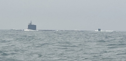
First Leg, Home to NY. Took 6 days. During that period, we saw it all, Heavy wind and large waves in the ocean, 2 days of thick fog in the Race where the currents are strong and the traffic can be heavy. One interesting note, a Submarine appeared out of nowhere in the fog. One day of absolute calm and 2 very pleasant days with perfect wind, waves, and temperature.
The first stop was Block Island. Easy till we reached the ocean. 15-20kt breeze, 4-6ft following seas. The boat does not handle well in a following sea, and just before we reached Point Judith the autopilot gave out. The heading was swinging back and forth. It would not hold a course and had a tendency to turn to stbd. In Block Island I switch to GPS heading as the reference. The autopilot settled out, but was still problematic and need to be watched.
I spent the next week trying to figure it out. Turns out here were 2 issues which made troubleshooting hard. The heading compass was loose and AC (Alternating Current) interference. The heading compass is located in the bottom of the helm station surrounded by wires (it took a while just to find it). It is mounted in a gimbaled sphere. Noticed the sphere was loose inside the gimbal. Tighten it down. The AC interference was harder to track down. Noticed that whenever we used the toaster the boat would start doing circles to stbd (it happens with any AC appliance, but it was the toaster that really stood out). Tried relocating the heading compass. Now when an AC appliance comes on boat does a 30° course change to stbd. The inteference is probably being induced by one of the wires in the bundle. That will take awhile to fix. In the meantime I think I can control it, so I can live wih it.
We spent 2 pleasant days on a mooring in Block Island. Ate at the Oar, no sunset, too cloudy, but the food was good. They did not charge us for the mooring. Nice. We left Block Island, 10 kts breeze, 2ft following seas. The boat rode easy. When we got to the Race, the fog came in. I do not like fog. Spent one night in New Haven. Next morning heavy fog to Stratford, 2 days in Stratford (because of the fog, did I say I did not like fog), one day in Stamford (No fog).
On to NY.
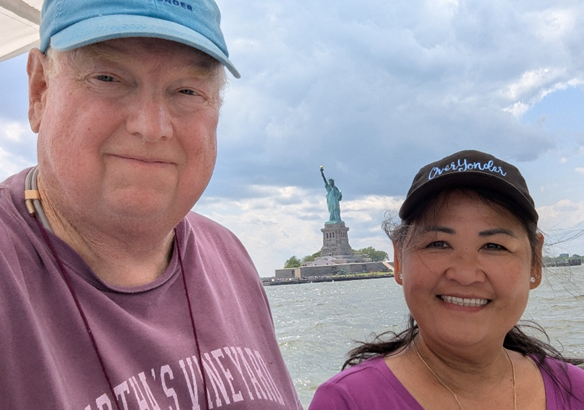
Entered NY thru LI Sound into the East River. Was interesting. It took 3 hrs to get from the Throgs Neck Bridge to the Statue of Liberty. Skyscrapers to the water edge the whole way. There were strong currents and lots of boat traffic, but the channel was wide, deep, and well-marked, so navigation was easy.
When you exit the East River into the Hudson River the Statue of Liberty is right there. For some reason just seeing the Statue of Liberty makes you feel good.
Now, a plug for Safe Harbor Marinas. When we had our troubles on the shakedown cruise last year, we ended up in Safe Harbor Onset. With the exception of the mechanic, they were very helpful and accommodating. Because of that I decided to become a member and use Safe Harbor Sakonnet in Portsmouth for the haul out. Again, they were very helpful and accommodating. As part of the membership, they offer complementary slip on an as available basis for transients (think it is easier to find a complementary slip for a 32ft boat vs a 52ft boat). We reach NY without any mooring or slip cost. We made a reservation at Liberty Marina in NJ. $250 a night! Welcome to NY.
We are now officially on the loop route.
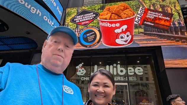
We spent 2 days in NY. Saw a Play. Ate out. Played with the street vendors. Watched the people. So many people. Every time I moved, I bumped into somebody. But everybody was friendly (even in NY) and it was easy to get around. I think Annie REALLY liked it. It did sort of remined me of Manila. Especially late in the day when all the vendors came out and it got crowded. (Imagine that it got even more crowded.) The last thing we did in NY was to stop by Jollibees. We got Chicken Joy. It is good chicken.
Hudson River: NY to Erie Canal
This leg took 14 days. The Hudson River is a tidal river all the way to Troy NY (the entrance to the Erie Canal). The current changes direction twice a day and in some places can exceed 2 kts. In the sailboat we would have played attention to the currents. In the power boat we just powered thru. As for the weather, 2 days of very hot (+100°), the rest was plesant with light winds, and occasional showers.
We left Liberty Marine he next morning and headed North on the Hudson. Spent the next 2 hrs gliding past skyscrapers. When we passed under the Tappen Zee bridge I considered us out of NY. We stopped at Safe Harbor Haverstraw. There is not a lot around the marina and walking was out since that was the days it was +100°. You need transportation to get anywhere. We spent 2 days there. They had a pool.
We left Haverstraw and headed north towards Poughkeepsie. Dropped anchor just past West Point for lunch. Had to get very close to the shore line the water was very deep and fast.
Stayed at Shadows Marine in Poughkeepsie. The Marina itself has very limited facilities, but the Dock master was a character, very helpful and made the stay worth it. Also, there is a lot to see and do in Poughkeepsie. In our case the walkway bridge across the Hudson was the highlight. The bridge is ½ mile long, there is an elevator, and the views are spectacular. We spent 2 days in Poughkeepsie.
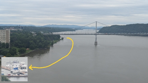
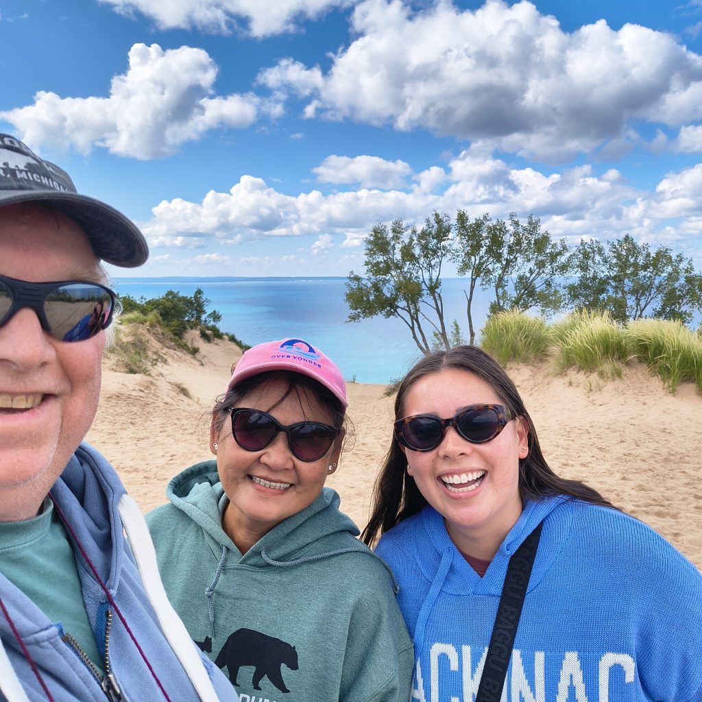
Note the insert shows Over Yonder.
We continued up the Hudson. As we passed Kingston I saw a sign for the Hudson River Maritime Museum in Kingston, NY. We stopped to check it out. Ended up staying 2 nights. There was an easy walking waterfront with the museum, restaurants, shops, and a relative good live band that was easy to enjoy at the slip without leaving the boat. As a note, there were a good many people hanging out on there boat enjoying the music.
The next day we motored up to Athens and anchored out.
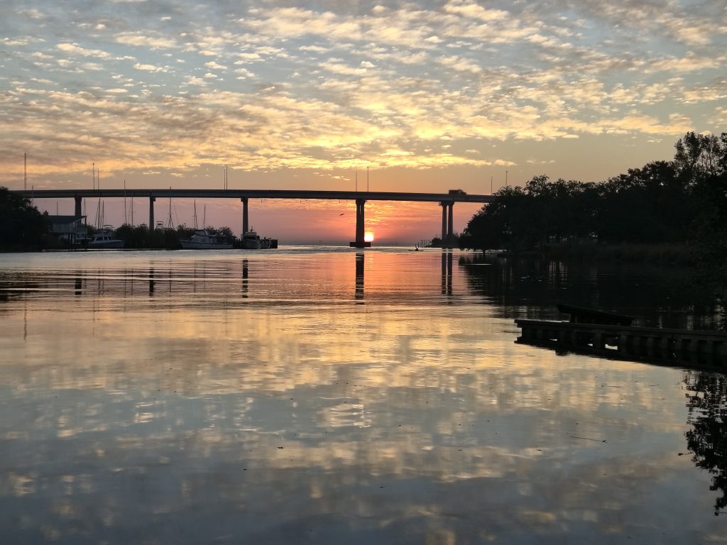
In Athens the Hudson is split into 2 channels with the main channel to the east. The west channel is protected from the main channel by an island, shallow, has good holding for anchoring, and good visibility north and south. It might be a little problematic in a blow, but the weather was hot and calm, but with enough breeze to keep the bugs away. We anchored close to the island next to the marsh. We saw hawks and large fishing jumping. We spent 2 nights anchored there. We ran the generator twice, 1hr at night inorder to run the AC before bed time. Other than that, we used the power indiscriminately. Even made carrot cake cookies, which mean the oven was on for +1 hr. With 2 days of indiscriminate power us the LIFePO4 batteries were at 28%.
We left Athens and headed toward Troy. Stopped at The Albany Yacht Club. It was an unplanned stop, but it was hot and they had a pool. Ate at the “Son of Egg” and toured the capital. Very Pleasant stay. We made plans to return for the 4th fireworks and then headed to Troy.
We ended up staying 4 days between Albany and Troy. Albany had a pool, the state capital, and fireworks on the 4th. Troy had more to do. Lots of shops and foods within easy walking distance. And, we used the city bikes to extend out range and went to the Burden Iron Works Museum. Well worth the trip.
While in Troy we order a few things thru Amazon for deliver to the Troy Downtown Marina. One of the items was a Cuisinart Ice Cream maker. We have used it twice as of this writing. Makes very good ice Cream. Very simple to use. I think it is going to become my favorite appliance on the boat
Erie/Oswego Canals
We spent 5 days on the Erie Canal and one on the Oswego Canal. The canals are very scenic, with lots of interesting sights and towns, And lots of locks. With that said there is one trait that can be used to classify a canal section into 1 of 2 categories that totally describes the canal, Manmade or River. The Manmade sections are long, straight, narrow, with very consistent depth. No Suprises. One other characteristic of the Manmade section is that the vegetation often grows right to the water edges. It reminds me of the old movies (like Apocalypse Now, African Queen, or Tarzan) where they are traveling thru the jungle by boat and the bad guys can attack at any time from the vegetation without being seen. The only characteristic that is common between the Manmade and River section is long. The River section is long, windy, often wide, and the depth can be anything. There are often surprises, and the scenery is spectacular. The vegetation can grow to the water’s edge or be a wide open meadows, there are marshes (and wildlife), houses, farms, and/or industry. In both cases there are lots of towns with free docks where you can get off the boat and explore. (Actually, there was one other section that could be characterized into its on category, Oneida Lake, 20 miles long, 5 miles wide. For our trip across it was calm, no waves, but a significant amount of boat traffic for a Thursday.)
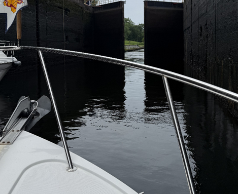
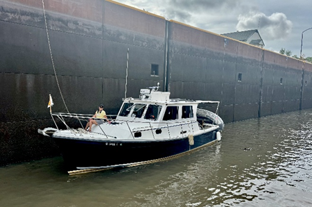
The Locks themselves can cause strange effects. As the water lowers the sun disappears, the Solar panels quit working. At the bottom any sound can cause strange echoes, Whispers can sound like shouts, water rushing in, and doors cracking and growing. You set in front of 2 doors that look like the doors on “Jurassic Park” and as they slowly creak open you expect a dinosaur to rush in. But, instead it opens to beautiful sunlight and calm water.
As for our trip thru the canal from Waterford to Oswego there were 31 Locks, the first 5 locks have to be completed in one go. They are very close to each other (a lock ever 1500ft) with a total lift of almost 450ft. The first 2 locks were a challenge for Annie and I. We knew the process as it was well published. It was the little things that got us, how to grab lines (what to grab), how to secure the lines, how the water would affect the boat as it filled the lock. It was a good thing we were at the bottom of the lock and nobody else could see us and our antics. But, by the end of the day, Lock 7, we had the process down.
We spent one night on anchor, 2 nights in marinas, and 3 nights on a free wall. The marinas had power and water, the free walls did not. The night we anchored out and one of the nights on the free wall it was very hot, no breeze, and lots of bugs. We drained the batteries running the AC the first night. The second we ran the generator to run the AC, but still made a dent in the battery charge. AC takes a lot of power. As for our stops; the first stop was the Waterford Visitor center. Very pleasant stop. There is an attendant that was able to answer most of our questions. We stopped at Ilions, Sylvan Beach, Johnsville, and Oswego. Ilions and Oswego were also convenient to shopping and grocery stores.
Kingston, Canada and the Thousand Island
We crossed Lake Ontario to Kingston, ON. We had a reservation at Kingston Marine. We had to cross the La Salle Causeway. The lift bridge was out. There was a shorter fixed bridge with a 15’ Clearance. Based on a measurements made at the marina I have an Air clearance of 14’. We were able to pass under it with about 1½’ clearance. Annie and I have a tradition of Kissing when we pass under a bridge, We did not kiss passing under this bridge, I was looking forward and down, listening for the crash. We made it, no problem. Then we kissed.
We spent 3 days in Kingston. They were having the Buskers festival. They closed off streets and the jugglers, fire eaters, and acrobats performed. Also, Kingston has a lot of restaurants, shops, limestone architecture, history, … It would be easy to spend 3 days here anytime.
After we left Kingston, we moved to Gananoque. Gananoque has a nice marina, easy walkable town, and 2 museums, Thousand Island Museum and the Thousand Island Boat Museum, both of which were enjoyable and I found out Thousand Island Dressing was invented here. They also have a playhouse right on the shore which we did not quite make it to. We did take the dinghy on a tour of the Islands, went swimming and had a picnic. We originally meant to spend 2 days in Gananoque, but the weather turned bad and we spent a 3rd day there. While waiting for the weather, one of the neighboring boats offered us the use of their car to going Grocery shopping. How do you say thank you to that?
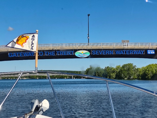
Trent-Severn Waterway
After Gananoque we headed toward the Trent-Severn Waterway. On the way we spent the night anchored in Picton Bay. It was a pleasant anchorage, but that night before bed I went to check the anchor. I shined a light down the anchor line toward the water. There was a solid mass of bugs leading from the water to our boat along the anchor line. It looked thick enough to walk on. The next morning there were dead bugs all over the aft cockpit. You could barely see the deck thru the dead bugs. They were easy to wash off, but ugg…
After Picton we traveled to Trent Port Marine at the mouth of the Trent-Severn waterway. Very nice facility with easy access to everything. I think they had the best bathroom/showers on the whole trip (Though all the bathroom/showers we saw in Canada were clean and well maintained.) We spent 2 nights there. The first night was a Friday and the marina had live music and a pooless party.
One other event occurred while at Trent Port. We had developed an exhaust leak on the generator exhaust manifold. It is located on the outboard aft section of the generator. Very hard for me to reach. I decided to try a temporary fix using hi-temp epoxy putty. It is usually carried at auto parts stores. There is a NAPA autoparts store approximately 1 mile from the marina. They open at 8AM Monday. I wanted to leave as early as possible on that Monday, so at 7:30 I walked to the store. Bought the putty and walked back. When I got to the Marina, I realized I did not have my wallet. I must have dropped it. I walked back to the auto parts store. It was laying in the middle of the sidewalk about a block from the store. I ended up walking 4 miles for the epoxy and we did not get out of the marine till almost 10AM.
After the Trent Port Marina, we entered the Trent Severn waterway.
We spent just over 3 weeks on the Trent Severn. The Trent Severn and the Erie-Oswego canals are very similar in that it consist of Manmade sections and Naturel River sections. In both cases, the Manmade sections are long, straight, narrow, with very consistent depth. No Suprises. The River section are long, windy, often wide, and the depth can be anything. After that they are totally different. To start, the water. The water temperature was in the mid 70’s and it was clean. You could see the bottom in 10 ft of water. And in some lakes (like Pigeon Lake) you could see it at 15ft. In the rivers and lakes the bottom was a mixture of weeds and sand. Some people are put off by sight of the weeds, but they are gentle in the water and I did not have any issues with them. As a note, the weeds may be one of the reasons the water was so clean. It was easy to find the sandy areas, and there were a couple sand bars we took the dingy to and walked around in waist deep water. The sandy areas were pleasant. We swim often.
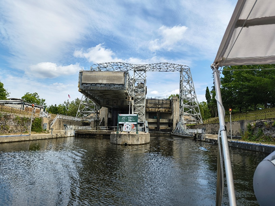
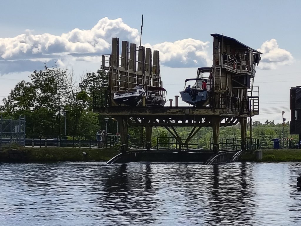
There were 4 types of locks on the Trent Severn. A standard lock as on the Erie. A Step Lock, where the output of one lock was the input of the second lock. A lift Lock, where the lock chamber is a water tight tub and the boat in the tub is lifted to the next level. And, A railroad chute, where the boat is placed on a travel lift and moved to the next level. The locks on the Trent Severn are sort of small and some are manually operated. Mostly by kids on summer break. The first couple of locks we had 4 boats in the Lock. I thought that was full. Then we had a lock with 6 Boats, plus the packed in a couple jet skyers and a pod of Kayakers. They had to shuffle boats around just to open and close the lock doors. It was interesting to watch (the first couple time).
As for where to stay at night, there were basically 4 options; “free” walls, “pay” walls, Anchoring, and Marinas. The “free” walls were around all the locks and in some of the towns. They all had bathroom facilities, but nothing else. The pay walls were located at some locks and had power, water, bathroom facilities, but no showers. Anchoring was possible pretty much anywhere at your discretion. For showers you need to stay at a marina.
The first night on the Trent Severn we spent on the town wall in Campbellford. I am supposed to get blood work once a month. I decide to try and do it in Campbellford. About ½ mile from the town wall was a walk-in clinic and a hospital. The process is to take the US lab request to an Ontario doctor. Get the US request translated into a format for the Ontario labs and then make an appointment with the lab. I was able to see a doctor right away at the walk-in clinic. I was not able to make a lab appointment till the next day. The whole process took 2 days. Note, I had to make an appointment with the lab, but not the doctor. Go figure.
Every place we stayed was good. Several places we checked into meaning to stay one night, but ended up staying 2-3 days because we were having such a good time or there was more to see and do. Several places had Concerts in the park next to the boat and we could listen and watch from the boat. Museums like the Canoe Museum, Area Museums, Natural History Museum, etc. And in Peterborough marina, the boaters on the dock we were on, invited us to their cook-out 2 nights in a row.
The last Lock (Lock 45) on the Trent Severn is the smallest lock (80 ft x 23 ft). Over Yonder is 11 ft wide. Two boats our size plus fenders would not fit by side (8”+11’+8”+11’+8“ = 24 ft). When we arrived, there were 5 boats in line. 3 large boats and 2 small boats. They were locking thru 1 large boat plus 2-3 small boats at a time. That lock was our longest wait to lock thru. There was no room on the wall, so it was a drift wait. Ugg. We locked thru with 1 large boat and 2 other small boats. And, it was tight. But, when the lock doors opened we were in the Georgian Bay and no more locks for +600 miles. Everything looked brighter.
Georgian Bay
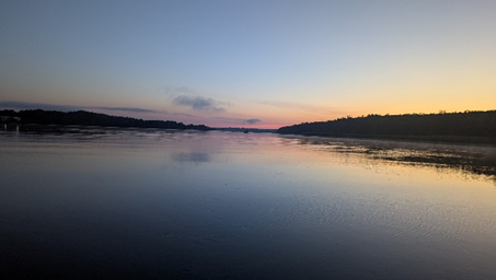
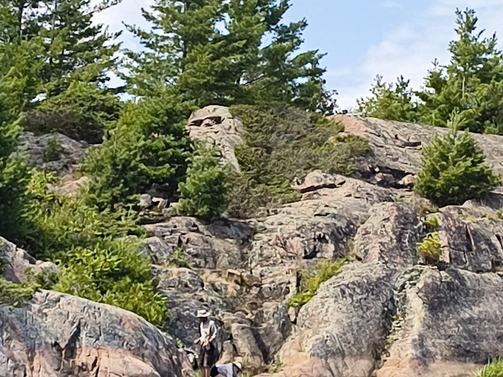
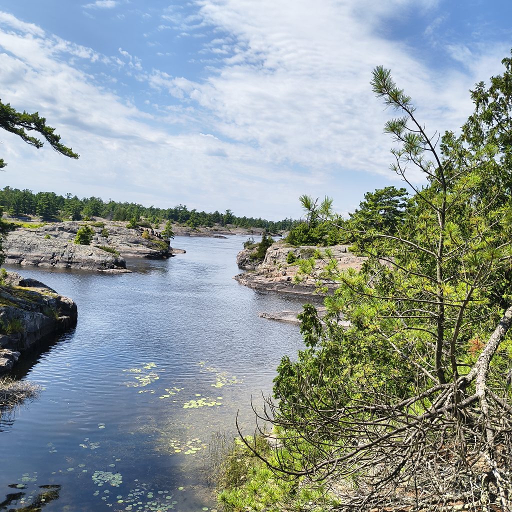
Georgian Bay is very pretty. Very Clear water, a little cold, but clear. There are lots of rocks, Granite rocks, shaped and sculpted by glaciers. Glaciers scaped away the earths surface, down to the bedrock leaving behind a very distinctive rocky landscape. Most of the islands are covered in wind swept pine trees. How they grow in the rock is amazing. The water depth varies a lot. This is one place you definitely want to stay in the channel. The first 2 nights we anchored in Indian bay and explored the area by dinghy. We ran aground in the dinghy often. The landscape is so picturesque, we took too many pictures.
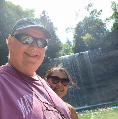
We stopped (spent the night) at Parry Sound, the birth place of Bobby Orr; The Bustard Islands, Good protected anchorage easy to get in and out off; Bad River, plenty of room and very picturesque. In Bad River we took the dinghy sightseeing and to (and on) the rapids; From Bad River we went up Beaver Stone Bay thru Collins Inlet to Killarney; Collins was like going down a fjord with tall granite cliffs; Killarney, very nice small town. You can walk down the middle of the main street and not be weary of cars; Baie Fine, the most isolated, prettiest place we visited. Note, everything is further away than you think. From the bay I saw where a rock slide had occurred in the past. The rocks were jumbled in a neat pattern. Then I saw that the rocks were as tall as the trees and realized that they were not rocks, but house size boulders; Benjamin Islands, we anchored in a cove between North and South Benjamin Islands. Protected anchorage easy to get in and out of. There were 20 other boats anchored in here; Kagawong, Visited the Bridal Veil Falls and swam in the pool, the Farmers Market, the Manitoulin Chocolate Works, and The Heritage Museum; Gore Bay, easy access to grocery store and hardware store, not many restaurants, but the one we visited was very good; The northwest end of Manitoulin Island, below Vidal Island. Anchored, It was our last stop in Canada.
Back to the USA
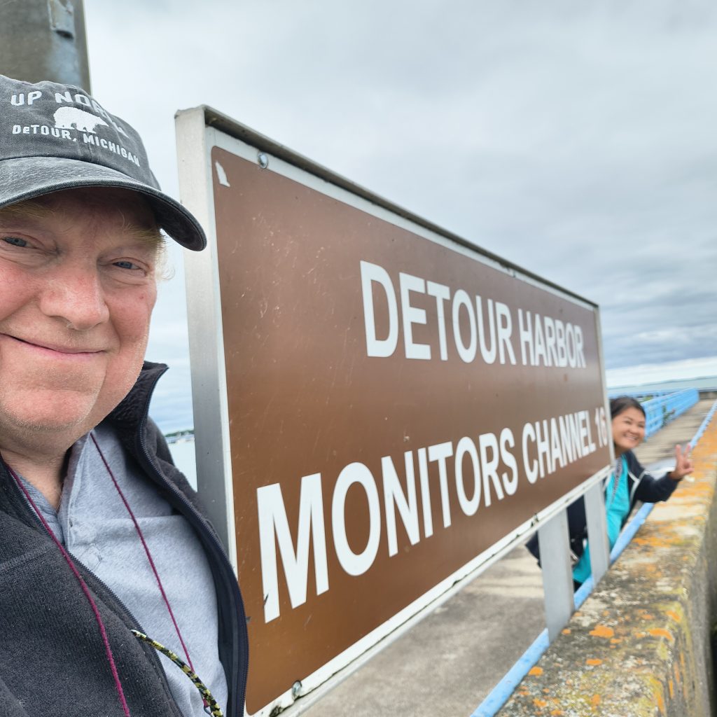
We reentered the USA thru De Tour, MI. We used the CBP Roaming app. The process was easy. Fill out all the information in the app. Press the Report Arrival button. An agent initiated a video call. Asked a few questions, then approved the entry. The hard part was the weather turned and we spent (were stuck) 4 days in De Tour. Very small town with 3 restaurants, 2 of which were always closed. The good part was the facilities were nice, and there were 7 other looper boats also stuck there. It turned into a 4 day social event capped off every evening with a docktails. Next was Mackinac Island. It sort of reminded me of Oak Bluffs on Martha’s Vineyard, but without the cars. People got around using bikes (no ebikes) and horse carriages. Since you cannot house train a house you can imagine the streets and smell. While there we rented bikes and rode around the island and there was a fort overlooking the town that we toured. (It seems that anytime there is something at the top of a hill Annie wants to do it). The weather was predicted to turn bad and we need to be in Traverse city by Monday so we cut our stay in Mackinac Island a day short.

Lake Michigan
We left Mackinac and entered Lake Michigan. We spent just over a month on Lake Michigan.
A few notes about Lake Michigan; It is big. Big enough that wind driven waves can build, but not big enough for them to round out. So, you end up with sharp, steep waves close together. In winds above 12 kts it can be uncomfortable and above 18 kts it can be dangerous. The NWS operates a weather portal specific for the great Lakes https://www.weather.gov/greatlakes/. We found it to be relative accurate with a good presentation as to what to expect on the lakes. Also, on the Michigan side the state maintains harbors about ever 25-30 miles making it easy to duck in someplace if the weather turns. They also make a good place to pull into and spend a few days just relaxing and enjoying the sights and local communities. Another thing we noticed was that the further north, the smaller the towns with the marinas right in town making it easy to provision etc. Whereas as you head south the towns and marinas separated more and more, increasing the need for some form of land transportation.
We stopped at 15 places along Lake Michigan spending 2-3 nights in each place. Note there were 2 occasions where our stay was extended by an additional 2-3 days due to weather.
Traverse Bay
Our first stop was Traverse Bay. On the map Traverse Bay looks small, especially when compared to Lake Michigan, but it is actually bigger than Narraganset bay. We spent a night in Northpoint at the entrance to Traverse Bay. The next night we anchored in a cove off of Traverse Bay and then arrived in Traverse City on Sunday. Eliza was scheduled to arrive Monday and we were going to spend a week in Traverse city so we rented a car. Picked up Eliza at the airport. And, spent 3 days touring the Traverse Bay area by car. Visited Sleeping Bear Sand dunes, Mackinaw City, and the Wineries. One other thing was that we bought ebikes on line for deliver to Traverse city. They delivered the bikes to 2 different locations. It was a good thing we had rented a car. Eliza returned the car to the airport and left on Saturday. We really enjoyed Eliza’s visit.
We left Traverse City, anchored one night in Traverse Bay at Hall Bay, one of the locals and his wife stopped by just to chat. They said their house was right there and if we would like we could use their shower and facilities. People everywhere are just nice
Lake Michigan Towns
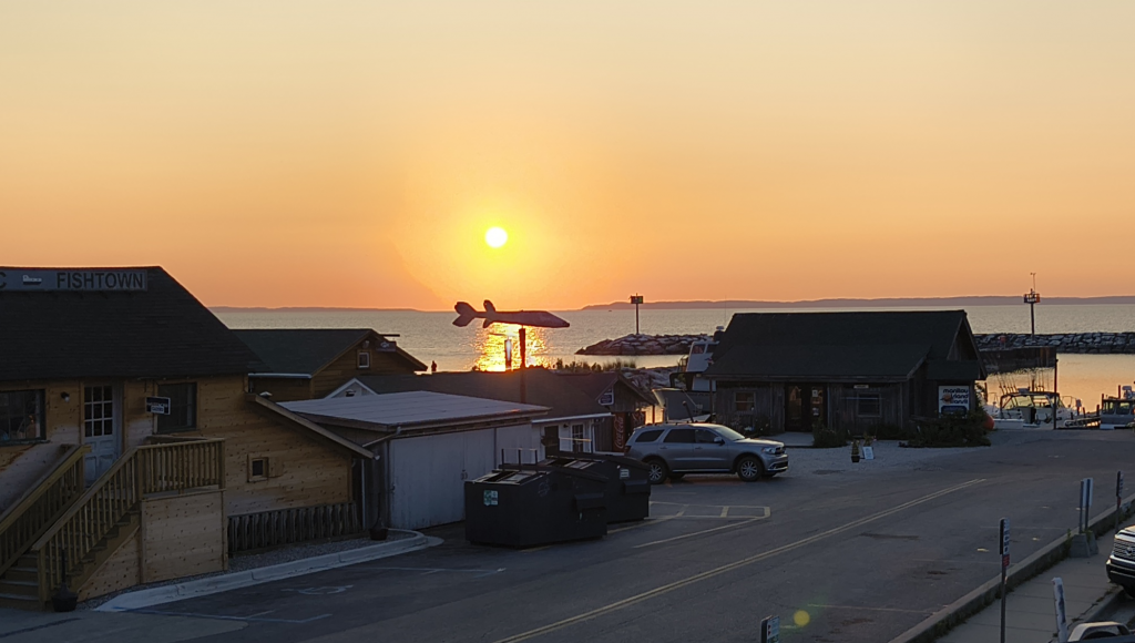
Outside of Traverse Bay is Leeland, also known as fish town. There were some fishing shacks on the waterfront that were converted to gift shops and eating places. It was picturesque and interesting. We only spent 1 night in Leland because the weather was supposed to turn and we wanted to get to Frankfort before it did.
We got to Frankfort, the weather turned and we spent 5 days in Frankfort. Frankfort is a little bigger city and there were several other loopers also stuck here, so we had plenty to do. We rode our bikes (to Crystal Lake). I got a haircut. Toured the Graceland Fruit plant. They had a good hardware store and I was able to perform a little maintenance. The women had a Girls Movie Night. And, docktails every night. As soon as the weather cleared, we all left for Ludington.
The weather turned again and the same group of people were stuck in Ludington for 3 nights. The Town was close and the food was good. We also went to the Ludington Maritime Museum. They had an exhibit about Railroad Car Ferries. I never knew there was such a thing.
The weather cleared and we went to Muskegon. Spent 2 night there. Nothing was close, We used the bikes to go to the grocery store, the marine supply store, and the beach. They also had the “USS Silversides Submarine Museum” which I found very interesting. One thing to note, as you enter the harbor you pass right by the “USS Silversides”.
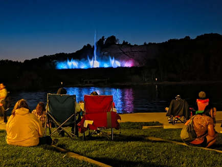
We spent 3 nights in Grand Haven. They have several marinas in Grand Haven, one of which is right down town making easy access to everything. We did not stay there. We stayed at the Safe Harbor marina, so the bikes came in handy again. One thing to note, the “Grand Have Musical Fountain”. You sit in the waterfront stadium which is downtown and watch the show on the bank across the river. It was entertaining.
Sagutuck was next. I just like saying that name. We spent 3 nights there. The marina was on the edge of town and was walkable, but we used the bikes. It was a pretty tourist town and looked like there was plenty to do, but we got there the weekend after they shut down for the season. Annie did get to play pickle ball there though.
Next was South Haven. We spent 2 nights there. The marina was close to downtown and we were able to walk to everything. We went to the beach. Annie swam, said the water was very cold. It was our last beach on lake Michigan. They also had a Maritime Museum that we enjoyed.
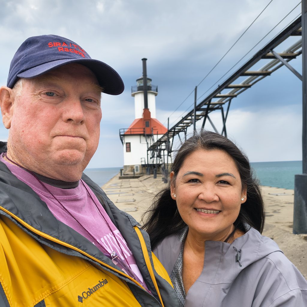
We spent I night in Benton Harbor/ St Joseph. The marina was not close to anything and to get to town you needed to cross a very busy bridge. And, it rained. So, we just walked to the lighthouse and call it a day.
Next was Michigan City, In. We spent 3 Nights there. The marina was not close to downtown, but they did have a “Lighthouse Museum” right next to the marina that we did find very interesting. There were other things that were “simi” nearby, but I did not feel like walking so Annie went by herself. She came back with that glow that said she enjoyed herself.
Chicago
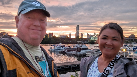
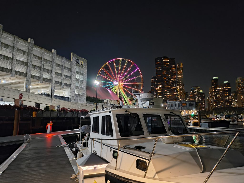
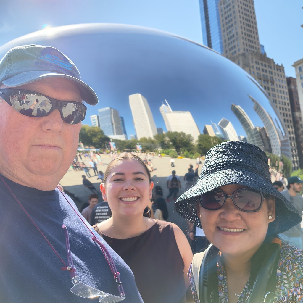
Our last stop on Lake Michigan was Chicago. We stayed at 2 places in Chicago; 3 nights at Belmont Harbor, about 5 miles north of downtown and 3 Nights at the Navy Pier, right in downtown. While in Belmont we took the subway to downtown, mainly to replace a phone. See The Phone Story for this story. Rode our bikes on the “Lake Front Trail”, a bike trail that runs 20 miles along the Chicago water front. My sister visited us and we went to “Boystown” for dinner. And, the next day our daughter came and we moved the boat to the Navy Pier in Chicago. The Navy Pier had just opened to transient boaters and it was one of the best places we stayed. The facilities were excellent and it was very convenient in that it was right downtown Chicago. We did the “Architectural Tour”, The Sears Tower, The River Walk, and just explored Chicago. Also, while there my niece visited and participated in and organized event (Half Marathon) in the south end.
After my sister and daughter left Annie and I proceeded down the Chicago river to Joliet. Annie and I have a tradition where we kiss anytime the boat passes under a bridge. We have been following that tradition for the last 30 years. It did not survive Chicago. There are 128 bridges between the Navy Pier and the Joliet Wall.
The Inland Rivers
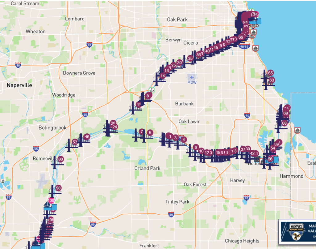
We spent 52 days on the Inland Rivers; The Chicago River, Des Plaines River, Illinois River, Mississippi River, Ohio River, Cumberland River, Tennessee River, Tenn-Tom, Tombigbee River, and the Mobile River. We anchored 15 times, stayed at 12 Marinas, and on 3 walls We passed thru 25 locks. Stopped at several small towns, including Ottawa, Peoria, Paducuka, Iuka (Corinth) Columbus, and Demopolis. And, we stopped at 4 major Cities; Chicago, St Louis, Nashville, and Mobile.
The northern sections (Chicago River, Des Plaines River, Illinois River, and Cumberland River) were a little more populated with urban centers and industrial areas and resources for the passing cruiser. The rivers were also little more tame in that they were well marked, consistent depth, and seemed to have fewer bends and turns with erosion control in play along most of the banks.
The southern sections (Tennessee River, Tenn-Tom, Tombigbee River, and the Mobile River) was less populated. It was not unusual to go 2-3 days without seeing any houses or industry. There are a lot of bends and elbows and very little erosion control and as a result there were a lot of deadheads and driftwood floating in the water. Sand bars were not uncommon and channel markers were sometimes missing or off station, and fog was not uncommon in the mornings. That said it was also very pretty. The night sky made me feel like a child again. There were red sand/clay cliffs, white chalk cliffs and in other places the trees came right down to the water and wildlife everywhere (we saw alligators below Demopolis and dolphins in Mobile Bay).
The middle section was the Mississippi and Ohio rivers. They were in a league all by themselves. Stronger currents, very wide, the barges were bigger, and you could see where man was trying to control the rivers, but the rivers still seemed to go where and how they wanted too.
One thing that was common to all section of the rivers were the barges. They were everywhere. The barge captains were professional, courteous, and very forgiving of our antics. (There was one time where I got in a tight situation with a barge, but was able to stick the bow of the boat into the mud just outside of the channel and let him pass.)
Inland River Towns
In Ottawa we stayed at the Heritage Harbor Marina. It was notable because a guest speaker who resides at the marine gave an overview of the river system. It was good local knowledge about rivers, how to communicate with the barges and locks, where to anchor, and what to expect, in general. The town of Ottawa was 2 miles away, but there was a very good bike trail that made the access to the town convenient.
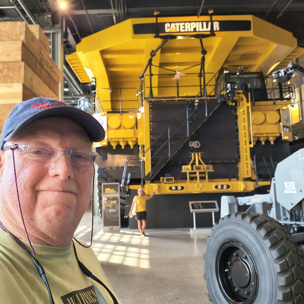
The next town place we stopped was a marina close to Perioria. However, it was not convenient to town because the road between the two was very busy and there was no bike trail. We decided to rent a car to see the local sites (The Caterpillar Visitor Center was well worth the trip) and drive to Springfield and visited the Lincoln library.
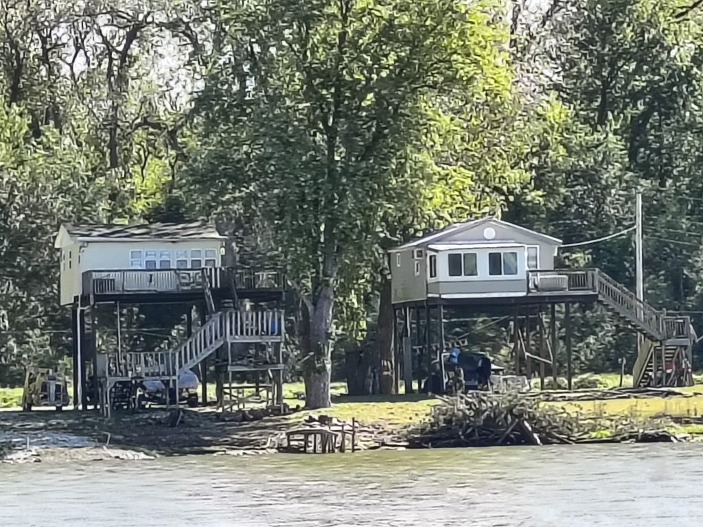
Grafton is located at the confluence of the Illinois and Mississippi rivers. We took the Skytour up to an overlook and were able to get good scenic views of the 2 rivers coming together. We also started seeing houses on stilts. And, the stilts seemed very tall to me about 20ft. We talked to one of the stilt house owners and he had seen water as high as the window sills.
Another thing to note is that while in Grafton we had some work done on the boat. The bill came to $1600. They wanted cash. Who carries that much cash.
The Alton Marina is the closest marina to St Louis and the last marina before the 248 mile stretch to the Paducah Transient Boat Dock. In Alton we rented a car drove to Saint Louis. We visited the Arc which was closed due to the government shutdown and the Louis and Clark Museum which was open.
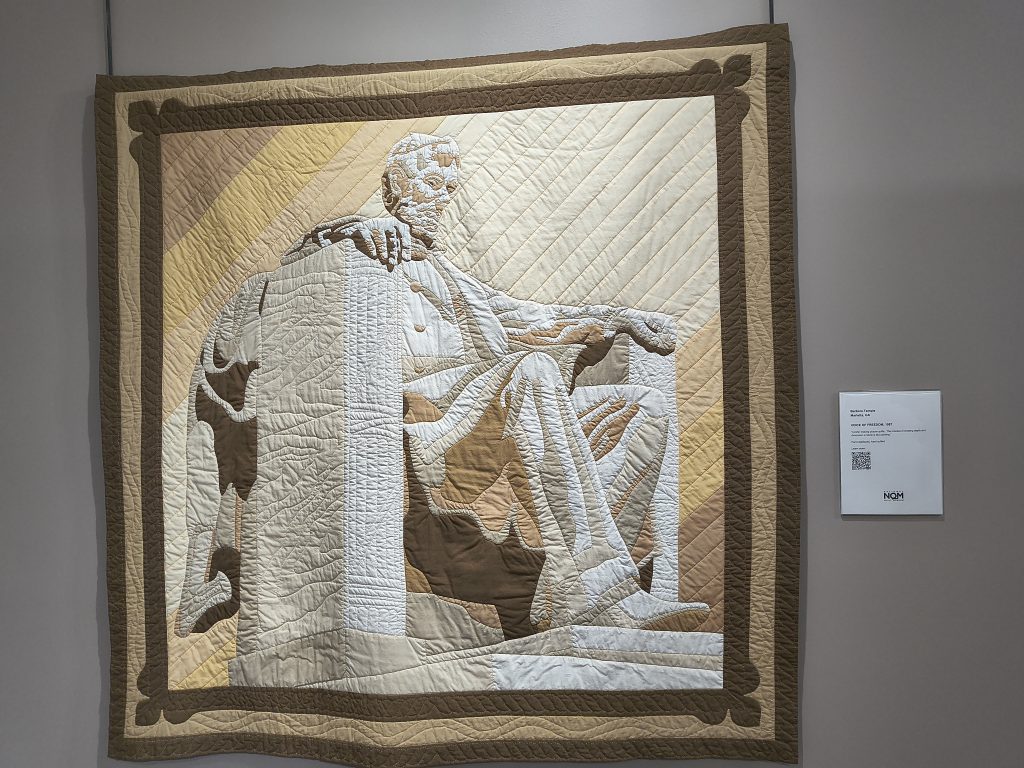
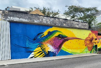
Paducah is where the Ohio, Tennessee, and Cumberland rivers come together. The town is very picturesque. The flood wall has a whole series of murals painted on it representing the history of the area. The town itself has many very nice restaurants. We visited the National Quilt Museum, the River Discovery Center, and went to a concert. As a note, Paducah Transient Boat Dock is exposed to the river and the river side can get a little rough. If you need to raft up there, I recommend only rafting up on the inside portion of the dock.
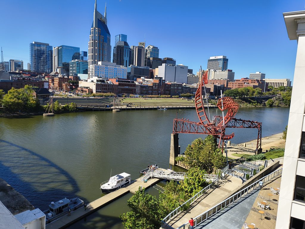
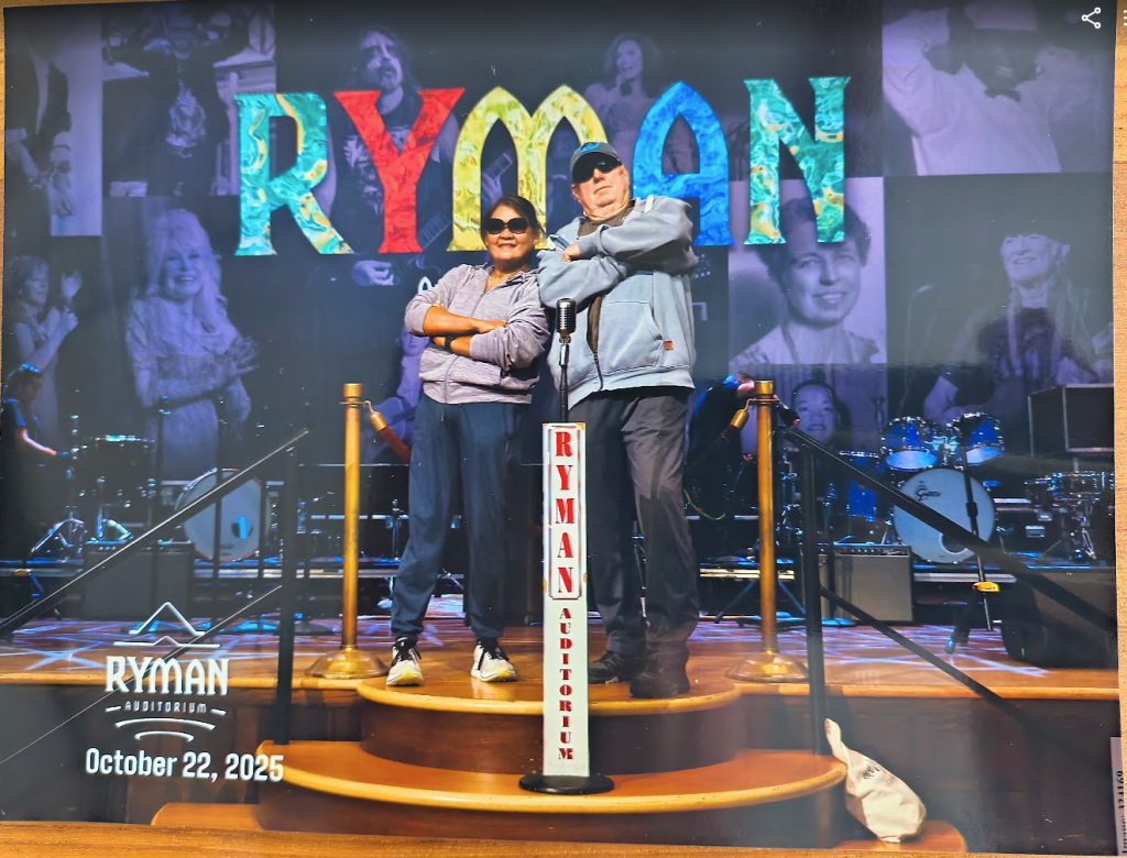
We spent 3 days at the Nashville Municipal Dock. They were filming “Nashville 911” and using the Municipal Dock as a staging area for some of the river scenes. It made the stay at the dock interesting. While in Nashville we visited the Country Western Museum, The Ryman center, and the Johnny Cash museum. Went to a show at the “Grand Old Opera” and at the Magic Dinner theater (They also did close up magic between the dinner and the show). There are a lot of bars in Nashville and every bar had a live band and was open the street. It was very loud. Annie enjoyed it. I did not.
Another thing of note was that one of the tour guides said that Nashville was a foodie town with all types of food and you could pretty much find anything you like to eat in Nashville. He then looked at Annie and asked what type of food do you like. She said she likes “Sea” food. The tour guide said “You are in the wrong town Lady”.
The Southern Section
Nashville was a side trip. We got back on the loop at the northern end of Kentucky Lake. From there we traveled down to the Safe Harbor Aqua Marine in Iuka MS. While there we visited Shiloh National Park, Corinth, MS, and Savannah, TN. A lot of history in that area.
After that we continued south 460 miles to Mobile. It took 19 days. We anchored out except for 2 nights at the Columbus Marina. While there my cousin Brian visited and we toured Columbus, MS. The birth place of Tennessee Williams. One night at Bobby’s Fish Camp. And, 2 nights in Demopolis where we visited with my cousin Eric.
Aground
One bit of excitement we had on this segment was that we ran aground around mile marker 383.5, between the Fulton and Wilkens Locks. We were the tail boat in a 3 boat convoy (Sea Positive, LI’L G, and us). We had exited the Fulton lock and were traveling at about 6-7 kts. The lead boat contacted the Wilkens lock and they said that if we get there soon, we could lock thru with the next locking. We increased our speed to about 18kts. I was adjusting the trim tabs and drifted to the side of the channel, but there was a green marker and I was well within the marker. The marker was off station. We hit the bank and came a sliding stop in about 2½ ft of water. We spent about 10 min trying to power ourself off the bank. We were not moving. We called Sea Tow. They had no resources in the area and could not find an independent contractor to help. We were on our own. In the meantime, the other 2 boats got to the lock and realized we were not with them. LI’L G contacted Annie who told them we were aground. They decided to come back for us. LI’L G pulled us off and Sea Positive filmed it.
Mobile
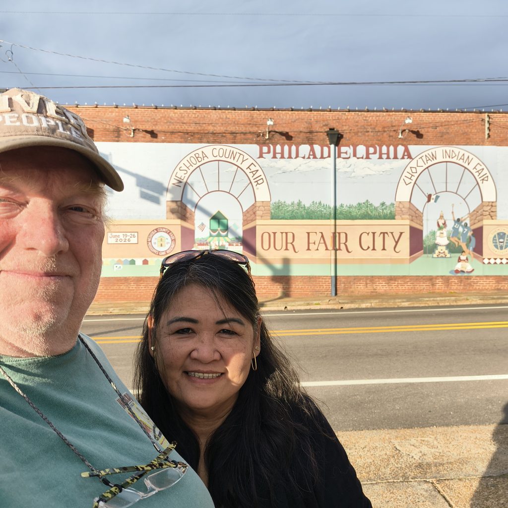
Mobile is the end of the inland rivers and our start of the Gulf Intercostal Water Way. We decided to spend thanksgiving week in Mobile (For thanksgiving we rented a car and drove to Philadelphia, MS to visit with the rest of my cousins.) Mobile sort of caught me by surprise. I did not know how much history resides here. The Continental Army did not fight here during the civil war, but the Spanish did and took it from the British. Then in the War of 1812 the US took it from the Spanish and it played a major role in the fight against the British. Then in the civil war the largest naval battle occurred in the mouth of Mobile Bay. The phrase “Dame the Torpedo’s, Full Speed Ahead” came from this battle. Mardi Gras was first celebration in the Americas was here. The Civil Rights moment had a huge impact from here. Mobile is a good place to dive and see the history.
The Emerald Coast
We left Mobile and proceeded to the Emeral coast (Orange Beach, Destin, Panama City, Apalachicola, and Carrabelle). We have been looking forward to traveling thru this area. We had been to this area before by car, but this time it was a bust. It turned cold and started raining. Even though we spent over a week with stops in Orange Beach, Destin, and Panama City we saw very little. It did not stop raining until we reached Apalachicola. (It was still cold, but at least no rain.) Our plan was to fuel up in Apalachicola, Anchor out, and cross the gulf the next day. There was another boat tied up to the fuel dock for the night. The marina said we could tie up to the wall and fuel up when they leave in the morning. The winds picked up, causing large waves in the Gulf. We decided to delay our crossing until the weather cooperated. It looked to be about 4to5 days. Also, we heard that the fuel was about a dollar a gallon cheater in Carrabelle. We decided to spend 2 days in Apalachicola, then move to Carrabelle, fuel up, and cross when a weather window opens.
We had a good time in Apalachicola. The first night we ate with some fellow loopers and then played bingo. Bonnie, from Goldilocks won ever game. That is one lucky lady. The next day we got the bikes out and explored the town. Very pretty town.
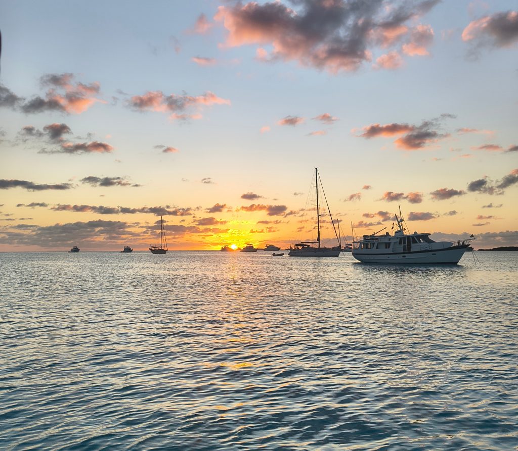
The next day we moved to Carrabelle. There were 40+ boat in Carrabelle waiting for a weather window. We had Docktails every night, the local restaurants were pretty good. We also got the bikes out and explored the tow; The world smallest police station, Light House and Museum, WWII DD Training Site, Small shops, etc. Then a window opened and boats started leaving.
The Gulf Crossing
We left Carrabelle at 2PM. We got to “R2” at about 3PM. There were about 10 other boats preparing to cross, planning on leaving from “R2” at 3PM. We joined them. There was a slight chop to start, but it calmed down after it became dark and was very smooth. We set the autopilot and adjusted the speed to stay with the other boats. Annie took the wheel at about 4 and keep it till 6. I took the wheel back just after sunset. 4 boats split off for Clearwater. We caught boats that left earlier. At around 10PM Annie took the tiller again. At around midnight I heard Annie talking to another boat on the radio. I got up. We were about 50ft from other boat. They had just past us. The Autopilots were taking us to the same point and they were traveling a little faster than us. They passed us very closely. I slow down a little and he changed course slightly. This added a little distance between us.
The stars were amazing and the moon came up around 2AM. Around 7AM it started getting lighter as the sun was coming up. About 20 miles from “R4”, at a water depth of about 40 ft, we started seeing crab pots. The bad part was that we were traveling into the sun and visibility was hard. The good part was that it was not Maine. There were crab pots, but nowhere near as many as in Maine. We pulled into the Tarpan Spring Municipal Marina. It took close to 20 hrs to cross from Carrabelle.
Florida Southern Gulf Coast
We spent a month on the Southern portion of the gulf coast. The weather was perfect and the gulf ICW is well marked making travel easy. We ended our time on the gulf coast with a 100 mile shot from Marco Island to Key west. That was the roughest part of the trip. We stayed at 7 marinas and 2 anchorages, visited with friends that had relocated from RI to Florida, had friends from RI visited with us, and our kids visited us for a week at Christmas. Two things to note. First, was the water temperature. It was in the mid-60s in Tarpan springs. It slowly got warmer as we headed down the cost. The first time we saw it above 70 was in the Gulf as we crossed from Marco Island to Key West. At the anchorage in Key West, it was 73°. I went swimming. Second, is that we saw Dolphins every time we moved.
Our first stop after crossing the Gulf from Carrabelle was Tarpan Springs. In Tarpan Springs we stayed at the Municipal marina next to the Sponge Docks. It looks like the Municipal marina is set up mainly for transients. The facilities were very close and easy to access. The Marina itself was right on the edge of the Sponge alley area and access to everting was easy. Greek culture and Greek food. As a note, Loopers that stayed at surrounding marinas traveled to Sponge Alley for the food and sights. Also, we were able to see Manatees at Craig Park. There is a trolly and a bike path that runs all the way to clearwater. We were there for 4 days, I could have stayed longer.
After Tarpan Springs we moved to Clearwater and stayed at the Clearwater Harbor marina. Another very nice setup with easy access to everything. We took the bike across the cause way and rode up and down the beach. It was nice, but nobody was in the water (The water temperature was in the 60s.)
We left Clearwater for Pier 77, just south of Tampa Bay, with an anchorage in Boca Cigna Bay. Lots of places to anchor. The weather was light and we had a pleasant night on anchor
The Marina at Pier 77 was nice, but it was sort of isolated and access to surrounding area was limited. The one thing the made it enjoyable was that our kids visited us and they rented a car. We were able to explore the surrounding area. Also, while there Annie and Eliza went to the beach while Duane and I worked on the generator. (Duane and I enjoyed that more than we would have the beach)
We moved to Regatta Point in Palmetto for Christmas. It was a nice marina, close to everything. As for our slip, it was a little shallow and we were setting in the mud at low tide, but it was a floating dock and access was easy and the facilities were right on the dock. While there we went to Busch Gardens and to the Manatee Viewing Center. There were 100+ Manatee there. They gather for the warm water from the power plant. Annis and Eliza went to the beach while Duane and I upgraded the electrical connection between the inverter and the batteries; And on Christmas we made Christmas Dinner on the boat. (Turkey, Potatoes, Lima Beans, Bread.) Duane and Eliza left 2 days later. We now have so much room on the boat.
Next we anchored in Little Sarasota Bay. Nice anchorage, we were the only boat anchored there. The next morning, we woke to Dolphins playing around the boat, jumping, twisting, turning. What a nice way to wake up.
The marina at Burnt Store was nice, but it is in the middle of a residential area and not close to anything. A car is necessary to get anywhere. The one saving grace was that they had pickle ball courts. At least it entertained Annie.
We moved to Sanibel Island for New Years. The plan was to do the “polar” plunge on New Years Day. The place they were going to have the plunge was about 6 miles from the marina. We rode the bikes. There was nobody there. The Plunge was actually suppose to be at a beach which was very close to the marina. We did not make it back in time. Annie did her on plunge anyway. The water was 67°, to cold for me. At any rate, the marina was close to the beach and there was a bike path that made access to shopping, groceries and hardware easy. Also, we had friends from RI visit us there. They talked about the weather in RI. That made the beach even better.
Our last stay on the Southern Florida Gulf Coast before crossing to Key West was Marco Island at Rose Marina. A very nice marina. There was a Cruise ship that would pull into there during the day. It keep it interesting. Also, it is a jumping off point for boats traveling to the Keys, so we saw several looper boats while there. There was no Bike path per say, but the sidewalks were wide and marked for bike use. It made getting around easy. (and even without the bike the stores were close enough to walk too). Two things we did while there were pickle ball and we rented a car, drove to the everglades and took an Air Boat ride to see the alligators. We had a good time on Marco Island.
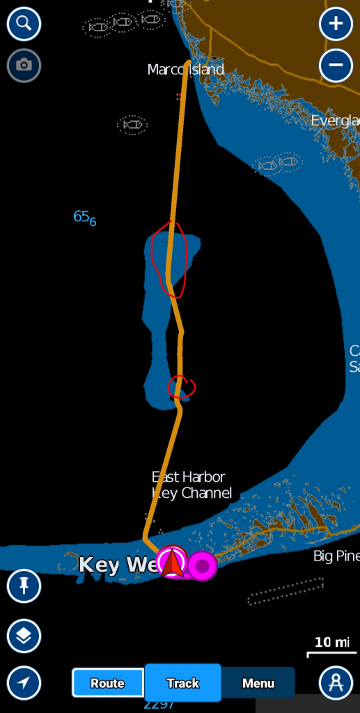
For crossing the Gulf from Marco Island to Key West, we left at about 6:45 (30 min before dawn). We had 2-3 foot seas on the beam which made it slightly uncomfortable, but we were able to make good speed and reached Key West around 2:30PM. The one thing to note is that half way across we passed and area that was saturated with crab pots (In Navionics when zoomed out it is the area in blue).
Key West
We spent 1½ months in Key West. It is a very busy place with lots of people, and plenty of resources for the cruiser (Marinas, repair services, marine stores, grocery supplies, restaurants). One thing to note, the closer you get too downtown, the more expensive it is. Bikes are everywhere and getting around by bike is easy. Our (my) only complaint was the cold front that passed thru. It reached the low 60s in key West, It dropped into the 30s in Miami, and frozen iguanas were falling out of the trees in central Florida.
When we arrived, we spent the first 2 days anchored in the harbor and celebrated my birthday on anchor. I baked a cake. Annie and I had a slice. it was very good. As we were finishing our slice a large boat came by and “waked” us. I had left the cake on the counter. The wake flipped the cake off the counter onto the floor. At least we each had a slice before we lost the cake. The next day we moved to Stack Island Marina. We originally planed on spending 4 days there, but the marina was nice, the bikes made it close to downtown, there were several other loopers there, and the price was reasonable when compared to the surrounding marinas, SO we stayed for a month. While there we went to a Jimmy Buffet tribute concert with some of the original band members. Saw “Hemingway In A Funny Way” at the Key West comedy show. Attended several Docktails, a pot luck dinner, a Superbowl party, and ate out with fellow loopers. In out spare time Annie did yoga and played pickleball and I did general maintenance in preparation for crossing to the Bahamas. (My favorite Hemingway story. He was married 4 times. His breakups were his fought and, in most cases, contentious. As he was finishing “The Old Man in the Sea” one of his wifes was reading it. Half way thru she put the book down and said “I forgive for everything”.)
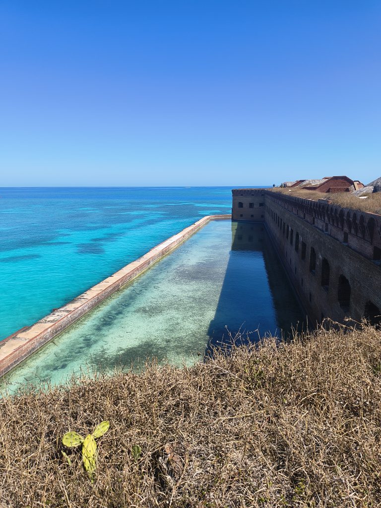
We had planned on visiting the Dry Tortugas, but the weather just was not cooperating. Then on our last day at Stock Island a 3 day weather window open. We and 10 other looper boats decided to go to the Dry Tortugas. To me that was the best side trip so far. The water was a beautiful turquois blue and the fort rises out of the sea.
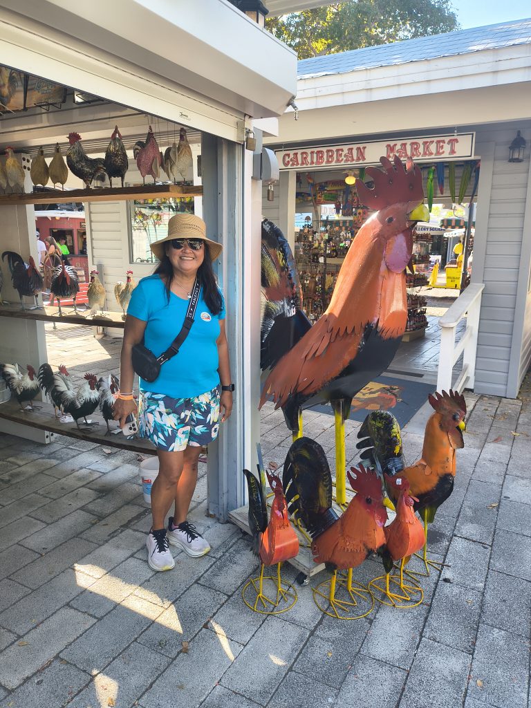
On the way back we anchored out one night at Boca Grande Key and then proceeded to The Gallon Marina in downtown Key West. The Gallon was very convenient. We walk out of the marina and we are on Duval St. right in the middle of everything. (Even the chickens.)
Marathon
We left Key West and proceeded up the Key on the North (Inland) side. The distance was greater and we had to watch our depth, but the wind was from the southeast making it the protected side and so a lot smoother. We went about halfway to Marathon and sent the night on anchor at Sawyer Key. A protected anchorage with lots of stars.
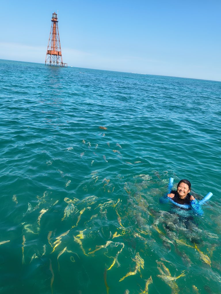
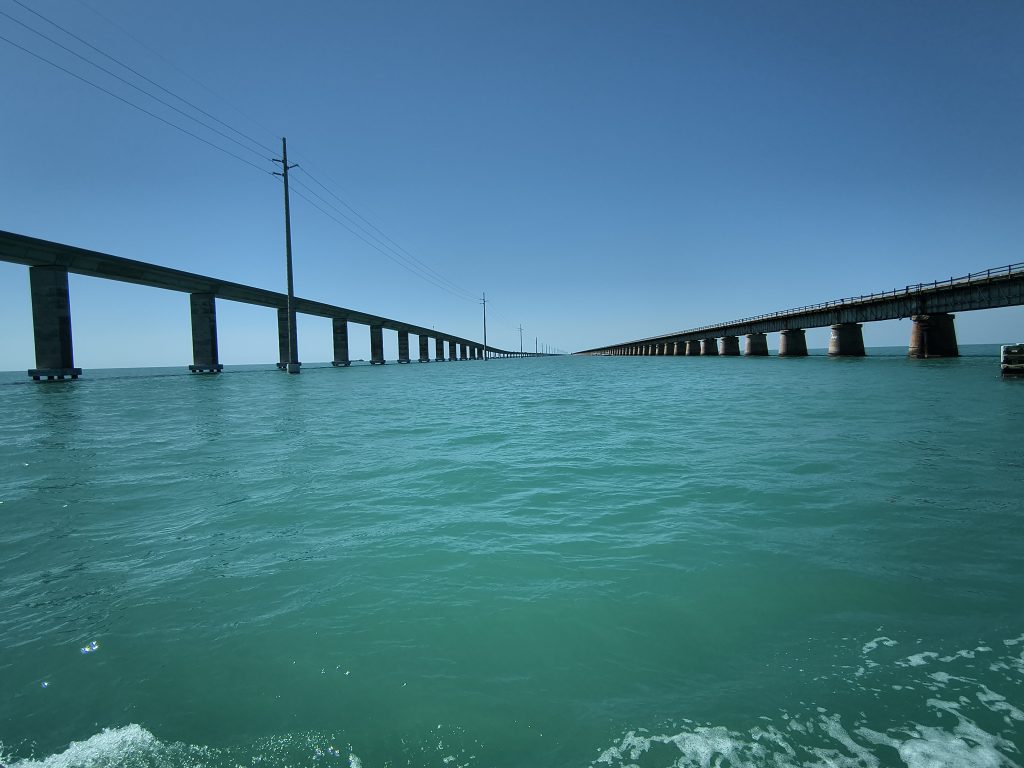
In Marathon, we stayed at the Safe Harbor Marathon marina. Very nice, well run, friendly marina. But, we have been away from home so long that our Safe Harbor membership had expired and we were not able to take advantage of any of the Safe Harbor member pricing benefits. (And, they were fully booked so …) Another thing that happened was that as we were getting ready to leave our Inverter/ Charger went out. They moved us to another slip and let us stay another 2 days while we waited for a new Invert/charger to arrive. The new Inverter/Charger arrived. I in stalled it. We left. Then we got the bill for the extra 2 days. It was significant higher then the previous few nights. When we asked to stay 2 extra days we did not ask about the cost, just assumed it would be the same, especially since and they did not mention there would be an increase. That lead to a slight contention. That said, we had a good time in Marathon. Went snorkeling at the Sombrero Key Light, toured the Turtle Hospital, biked on the Old Seven Mile bridge, spent time at and in the pool, and ate out with fellow loopers. After a week we left Marathon and continued up the Keys. We anchored one night close to Pumpkin Key. And then the next day crossed the keys at Angelfish creek and then crossed the Gulf Stream to Bimini.
Bahamas
We crossed the Gulf Stream starting at Angelfish creek in the northern part of Key Largo. Crossing the keys we were traveling south east, right into the sunrise. When we got into the Gulf Stream we turned toward the northeast and could see again. We were traveling with the Gulf Stream and had 1 ft waves from the north, it was a little choppy, but we covered the about 60 miles to Bimini in 5 hrs (12 mph) and only used about 30 gallons of diesel. At the entrance to Bimini, I turn north a little early and touched bottom. I should have gone closer to shore before turning north. We pulled into the Big Game Marina and cleared customs and immigration. We had filled out all the paperwork and paid the fees beforehand using the Click2Clear app and so everything went easy.
Bimini
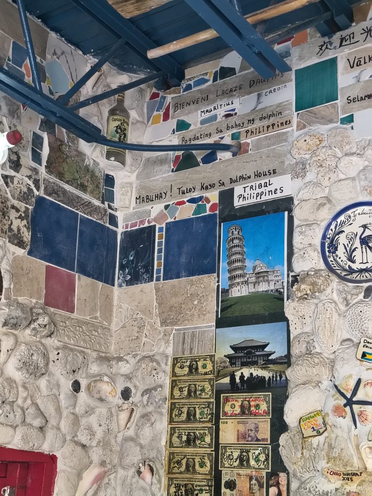
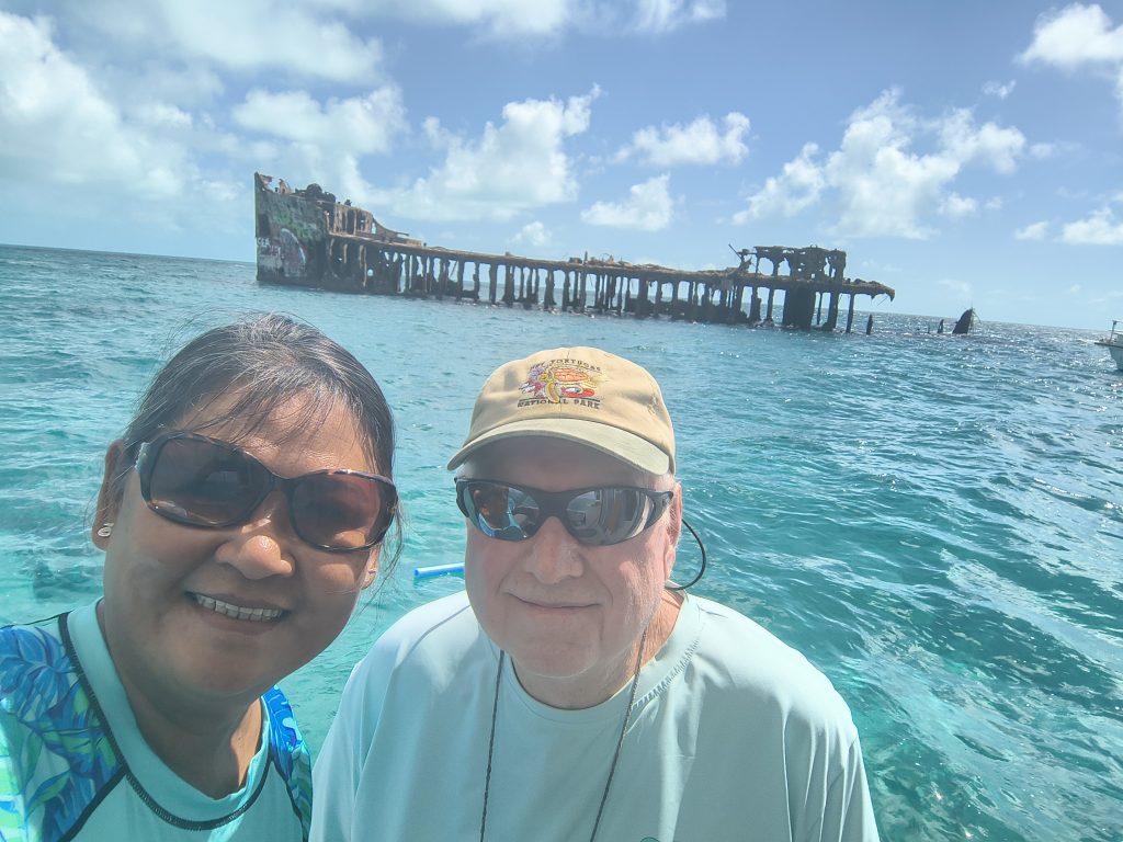
The 10 day forecast for the norther Bahamas was high winds and waves. We ended up staying 12 days in Bimini. Bimini is about 7 miles long with 2 roads running north/south, only one of which runs the entire length. The norther section has the resorts, casino, and cruise ships, the southern section is where the working marinas are. While in Bimini we visited the Dolphin house (well worth the visit). The casino (not worth the visit). Snorkeled the wreck of the Sapona (the Concrete Ship). Visited Radio Beach. And, shopped and ate.
After Bimini we crossed the Great Bahama Bank to Chub Cay in the Berry Islands. Spent a very rollie night and crossed to Nassau the next morning.
Nassau
I enjoyed Nassau. The entrance to Nassau Harbor is easy, but it is one of the busiest harbors I have visited, and it is a controlled harbor and you need to get permission from Harbor Control on channel 16/9 before entering the Harbor. They will ask for the boat name, registration, last port of call and destination in Nassau. It is the largest city in the Bahamas and the center of everything Bahama related. There are lots of resources supporting the local population. A large tourist industry (Atlantis, Straw markets, restaurants, beaches, and sightseeing). And, a lot of resources for the marine industry. We were in Nassau for 4 days and busy the whole time (beaches, sightseeing, touring the forts, the fish fry, the Queens Stairway, and shopping).
Exumas
We left Nassau and crossed to the Northern Exuma Cays. The wind shifted to the North and we spent a rollie night anchored off of Highborn Cay. The weather was forcast to get a little worse for the next few days so we moved to the Land and Sea Park and got a mooring at Wendrick Wells. The weather kept us there for 4 days. We were moored in 10ft of water, there was a sand bar about 20 ft from the boat that was above were at low tide. The water was very clear. You could see the stingrays and sharks on the bottom. And you could even see the bottom at night. The first day it was too windy to get off the boat, but after that we able to play. There was a reef with lots of coral and fish. I was able to snorkel, but the current was strong and water access was by dingy which made things difficult. We did explore the sand bar, climb to the top of Booboo hill, went to the beach, and had a “Beachtails” with the other cruisers.
After we left Wendrick Wells Cay we traveled south to Staniel Cay. Along the way we saw an Island named Overyonder Cay. It was a private Island. We decided to go on the outside so we could pass close to it and take pictures.
At Staniel Cay we anchored off of Pig Beach. We visited the pigs, and then meet some other loopers and they took us to Thunderball Grotto (after the James Bond movie). I swam inside. It was cathedral like with fish. There was a current, but there were ropes so that you could pull yourself thru.
We then proceed north to Shroud Cay and anchored in the north anchorage. There are channels thru the Mangroves and you can travel to the ocean side using the channels. We saw turtles and stingrays in the channels. The area where the channel exit into the ocean is called the Washing Machine. The channel is deep and the current is strong, but when it hits the ocean, it gets very shallow. You can float in the fast current and when it gets shallow you can stand up and walk out. It was fun, we did it over and over.
Abacos
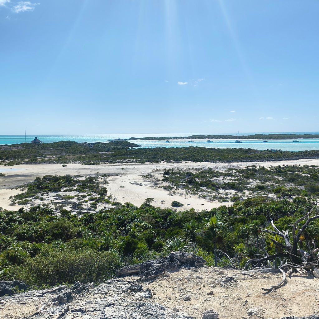
Our next goal was the Abacos. There were 2 ways to get there. One around the southern tip which would take 2 days and require 2 deep water (ocean) crossing or around the northern tip which would take 3 days and require crossing the Bight of Abaco, a shallow semi-protected area. Since we only had a one day weather widow we decided on the northern route and 3 days. We travel back to Nassau got fuel in Nassau Harbor at Browns Marina and then proceeded to the West Bay and anchored for the night. The next day we went to Grand Harbor marina in the Berry Islands. There were 3 other loopers in Grand Harbor marina and about 10-12 PDQ power cats. They were having a rendezvous. The Looper Docktales and the PDQ rendezvous combined for one big party. The next day we crossed the Northwest Providence channel and entered the Bight of Abaco at Channel Rock and 8 hrs. later exited via the Spencer Rock channel. The shallowest area was the Spencer channel. We got to the entrance of channel about 1 hr after the Nassau high tide. The min depth we saw was 6 ft. We spent the night at Cave Cay. That was the prettiest night of the whole trip. To start with, no light pollution (we did not see anybody from the time we entered the Bight till we got to Spanish Cay). The moon (a half-moon) was very high and bright. There were stars, more stars than I have ever seen. And large puffy clouds. The moon lit the clouds up from behind. So, you saw these very bright fluffy white clouds superimposed on the night sky with more stars than possible. It was strange and beautiful.
The next day we enter the Sea of Abaco and spent 3 weeks there. We visited No Name Cay (swimming pigs and Big O restaurant), Hope Town (quant town and light house), Tahiti Beach (a very pretty beach with a food boat, it is like a food truck, only it is a boat), Marsh Harbor (the 3rd biggest town in the Bahamas), Great Guana Cay (Nippers and Grabbers), Man-of-War Cay (quant town with shops like Albury’s Sail Shop), and Green Turtle Cay. We were in Green Turtle for a week, waiting out a blow. It was a good place to spend a week, because there was plenty to do and see. The Tranquil Turtle beach, Coca Bay sting rays, turtles, sharks and fish. New Plymouth, breakfast at the Liquor Store. And Pineapples Bar and Grill.
The Sea of Abaco is a good, relative protected cursing area and all the destination are relative close, so no long transients. The only challenging section is the “Whale”, but waiting for a high tide or a weather window makes getting thru or around easy.
Westend
We made the trip from Green Turtle to Westend in 2 days with a stop at Great Sale Cay. Great Sale Cay is a deserted Island with no resources, but it does have a relative protected anchorage. When we got to Great Sale Cay there were 4 boats in the anchorage. There were 24 by the time it was dark and 26 when I got up in the morning. Low tide at Westend was scheduled for midday. We planned on taking the Goodwill Channel by way of Indian Rock, a very shallow area, so we took our time leaving Great Sale Cay and arrived at the entrance to Goodwill channel about 2 hrs after low tide. The lowest depth we saw was 5.5 ft. There was a 3 day weather window opening up for the gulf crossing. Our original plan was to spend one night Westend. Then go to Freeport. Spend 2 nights in Freeport. And, then cross the Gulf Stream to West Palm Beach. But, as we were exiting Goodwill channel the engine started making a screaming sound. One of the fan belt Idler Pulleys went out. It needed to be replaced. Annie talked to the Dock master and got the number of a mechanic. He was able to find another Idler pulley and replace it. But, now we did not have enough time to take the boat to Freeport.
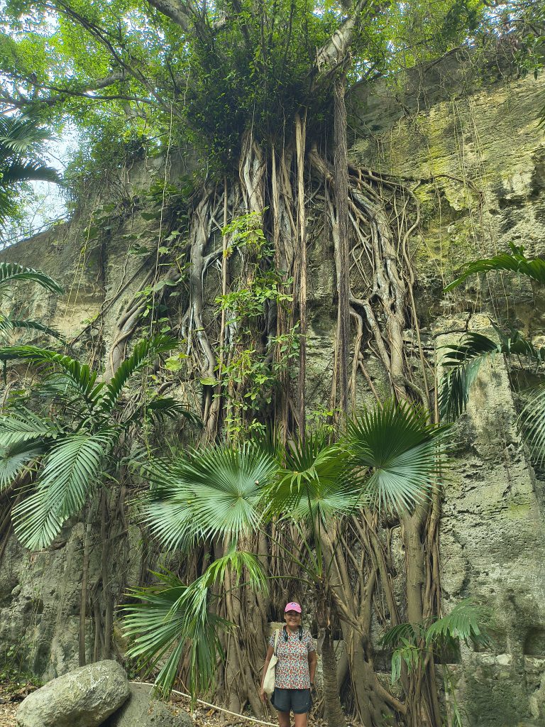
We decided to rent a car and drive. We saw Freeport and was able drive all the way to Lucayan National Park. It had one of the prettiest beaches we saw in the Bahamas and a relative interesting cave system you could visit.
Gulf Stream Crossing
The next day we crossed the Gulf Stream, ending our stay in the Bahamas. It was as easy crossing. Wind behind us, waves less than 1 ft, very little chop. Till we reached the Lake Worth inlet, then it became rough and crowded.
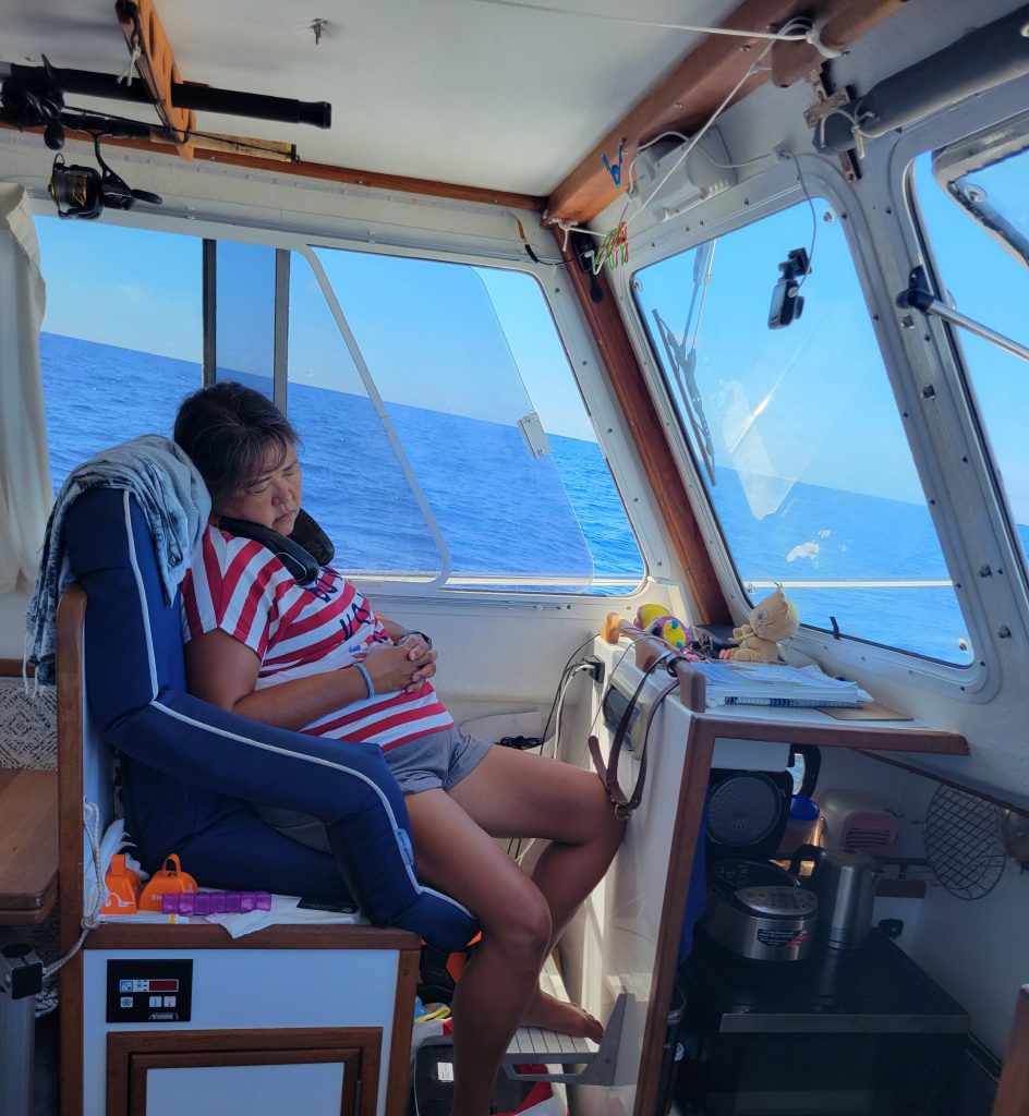
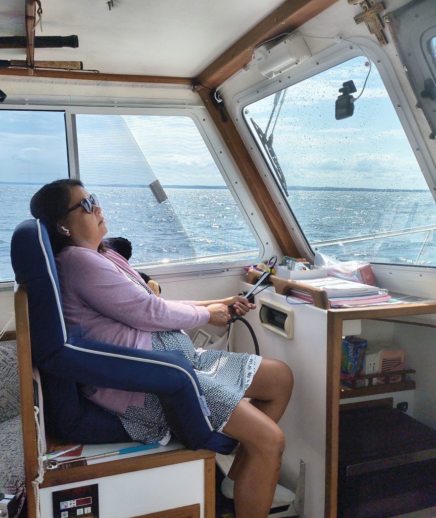
Crossing from Key Largo To Bimini (Note, Annie is holding on while sleeping)
Crossing from Westend to West Palm Beach (Note, Annie is sleeping like an old salt)